About the Preserve
Kenilworth Forest can be entered from Kenilworth Drive and Christina Court. It is bounded by those two roads as well as Airline Road, Pepperbush Drive, Olde Orchard Road and Fox Hill Drive. It was preserved and donated to the Trust as part of open space set aside requirements for subdivision approvals and is located in the northwest corner of Clinton.

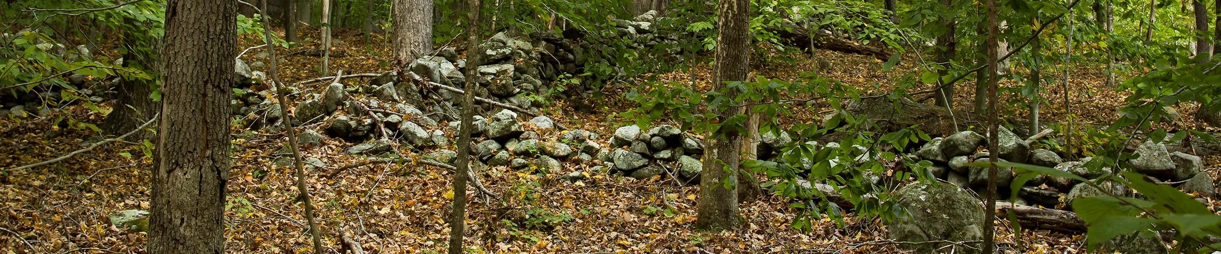
If you hike the entire 85 acres of trail network of the Kenilworth Forest, you will have walked approximately 4 miles in the woods. The blue blazed trail is the longest and stretches from the main entrance south to the yellow blazed Deane Haag connector trail, west to the Christina Court entrance and north to the loop behind Olde Orchard Road. Portions of the blue trail are located on old abandoned roads, one named “Old Burncoat Road” which one can imagine may have quite a story behind it. Old roads can be identified by their width and because they were often lined by stonewalls or cut into the side of a hill. The section of the blue trail that heads west crosses over a stream next to a damn built to create a small pond that was likely used to water livestock.
Deanne Haag Trail
This is the first hiking trail that was blazed by the Trust in 1967. It was named in memory of Deane Haag, a founding member of the Trust. William H. Smith, an assistant dean and associate professor at the School of Forestry and Environmental Studies of Yale University prepared a Guide to the Deane Haag Nature Trail in 1977. The guide identifies and describes 35 species of trees growing along the trail and the geology and soils of the forest.
The Deane Haag trail is a loop trail that crosses a stream with foot bridges at the north near Kenilworth Drive and at the south near Airline Road. It has a ledge outcropping along its eastern side that young children can peer into and imagine a cave with hibernating animals waiting for spring. The western side of the trail follows a ridge along a stone wall and looks down at the valley below where the stream meanders through the property. This trail has its own entry point on Kenilworth Drive that is identified by a stone marker or it can be accessed from the blue trail that is found at the eastern cul-de-sac of Kenilworth Drive.
Pastures, firewood and charcoal
Besides clearing the land for fields and pastures, the Kenilworth Forest also was once used for harvesting firewood and making charcoal. Along the red blazed trail between a ledge outcropping and a stream, you can see a stone fire pit made to last for more than just a weekend camping trip. A collier probably lived in this forest in a crude shelter while he tended his charcoal pit for weeks at a time. Wood would be carefully stacked in a pile and then covered with leaves and dirt to restrict the oxygen flow while it burned. The collier’s job was to ensure the wood burned just slow enough to release all its moisture and become a pile of charcoal. If careful attention to the process was not paid, the wood would turn to worthless ash. The firepit is how the collier stayed warm and cooked his meals. It’s all that remains of a likely charcoal production operation in the Kenilworth Forest over 150 years ago.
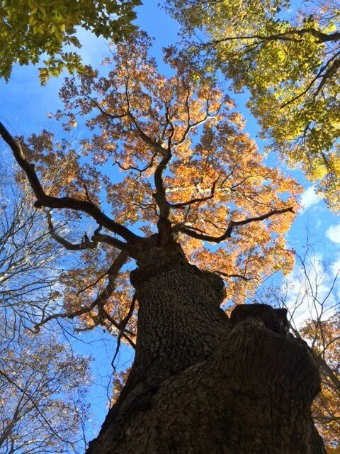
Poppa Oak
Along the yellow blazed trail stands a giant white oak tree stretching to the sky. This tree is the oldest in the forest and is estimated to be well over 200 years old. White oaks grow slowly and can live for 400 years! This one is a border tree seemingly growing right out of an old stone wall. It was left to grow in full sunlight for many years to provide shade for livestock. Children growing up in the Pepperbush Drive neighborhood informally named it “Poppa Oak.” If only Poppa Oak could tell us what the land here looked like 200 years ago. With all the other trees cleared for grazing animals and growing crops, you likely could see for miles, perhaps all the way to Long Island Sound. What will this forest look like 200 years from now? Will Poppa Oak and his acorn offspring still be standing tall?

As you walk through the Kenilworth Forest you will see stone walls that marked the boundaries of former fields and pastures and old roads. You also will see wetlands, ledges and slopes that were not pastured or plowed. The former fields have been reclaimed by the trees and shrubs of the forest over the last hundred or more years as life in Clinton changed. The wetlands and ledge areas were continuously forested, but also harvested for wood and ravaged by fire, windstorms and other natural events. As you walk our trails, try to imagine what the area looked like before the Europeans first arrived, how it changed with the settlers and farmers, how it changed when the farms and woodlots were abandoned and what it might look like 100 years from now.
